Published
From Ireland to Italy, Portugal to Poland, Germany to Greece, and everywhere in between, explore your ancestors' European homelands through gorgeous reproductions of 18th-century maps, 19th-century maps and early 20th-century maps. More than 200 full-colour historical maps, covering the peak years of European immigration to the rest of the world, it will help you understand changing boundaries in ancestral countries, and inform your search for genealogical records.
The Family Tree Historical Maps Book of Europe features:
- Historical maps of the European continent showing how national borders evolved during the 1700s, 1800s and early 1900s, when most so many European's emigrated
- Detailed country maps illustrating key geographical units, provinces, counties, regions, cities and more
- Time lines of important events in each country's history
- Lists of administrative divisions by country for easy reference
- A complete index listing the title and online source of each map, so you can view maps of interest in greater detail
More information:
https://www.gould.com.au/the-family-tree-historical-maps-book-of-europe-a-country-by-country-atlas-of-european-history-1700s-1900s/bwy026/
More titles relating to European genealogy and history:
https://www.gould.com.au/overseas/europe/
#genealogy #EuropeanHistory #OldMaps
- Category
- History
Be the first to comment
-
00:09

#countries #world #travel #country #geography #maps #europe #map #history #flags #asia #nature #usa
-
09:12
Gaustad's Historical Atlas of Religion in America - A Book Review
-
00:15
Europe country now vs then #flags #map #country #short #history #meme #historical #ww2
-
12:53
Largest Community outside each country in Europe || Interesting MAPS 1
-
00:13
#countries #world #travel #country #geography #maps #europe #map #history #flags #asia #bholenath
-
00:16
country vs country #flags #flags #country #map #short #history #meme #historical #ww2
-
00:26
country now vs then#short #country #history #meme #serbia #sverige #denmark #europe #historical
-
00:06
Pov: You were born in Europe ???? #europe #mapping #map #geography #country #history #foryou #maps #
-
00:20
Europe country flags now vs WW2 #flags #flags #map #country #short #history #meme #historical #ww2
-
00:17
Country now vs then #flags #meme #historical #country #ww2 #history #map #poland #sverige #france
-
13:18

American Civil War from The European Perspective | Animated History
-
3:00:04

Alternate History of Europe: The Movie
-
58:37

Alternative history of Europe - The MOVIE
-
03:39

Watch how 1000 years of European borders change. Time Lapse Map
-
17:41

Proto-Indo-European Origins | DNA
-
1:18:59

Alternate History of Europe (Le destin de l'Europe): The Movie
-
03:34
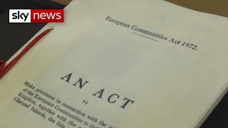
Britain's difficult history with Europe
-
02:56

Origins of the European Flags
-
02:00

History of Europe: XIX century (From 1815)
-
11:42

History of Europe and North Africa : Every Year
